Save as GeoJSON or shapefile
5 minutes, included in the live session if you attend
Now that you have imported your locations into QGIS, we recommend that you save them as a geospatial file, either in GeoJSON format, or shapefile if you prefer
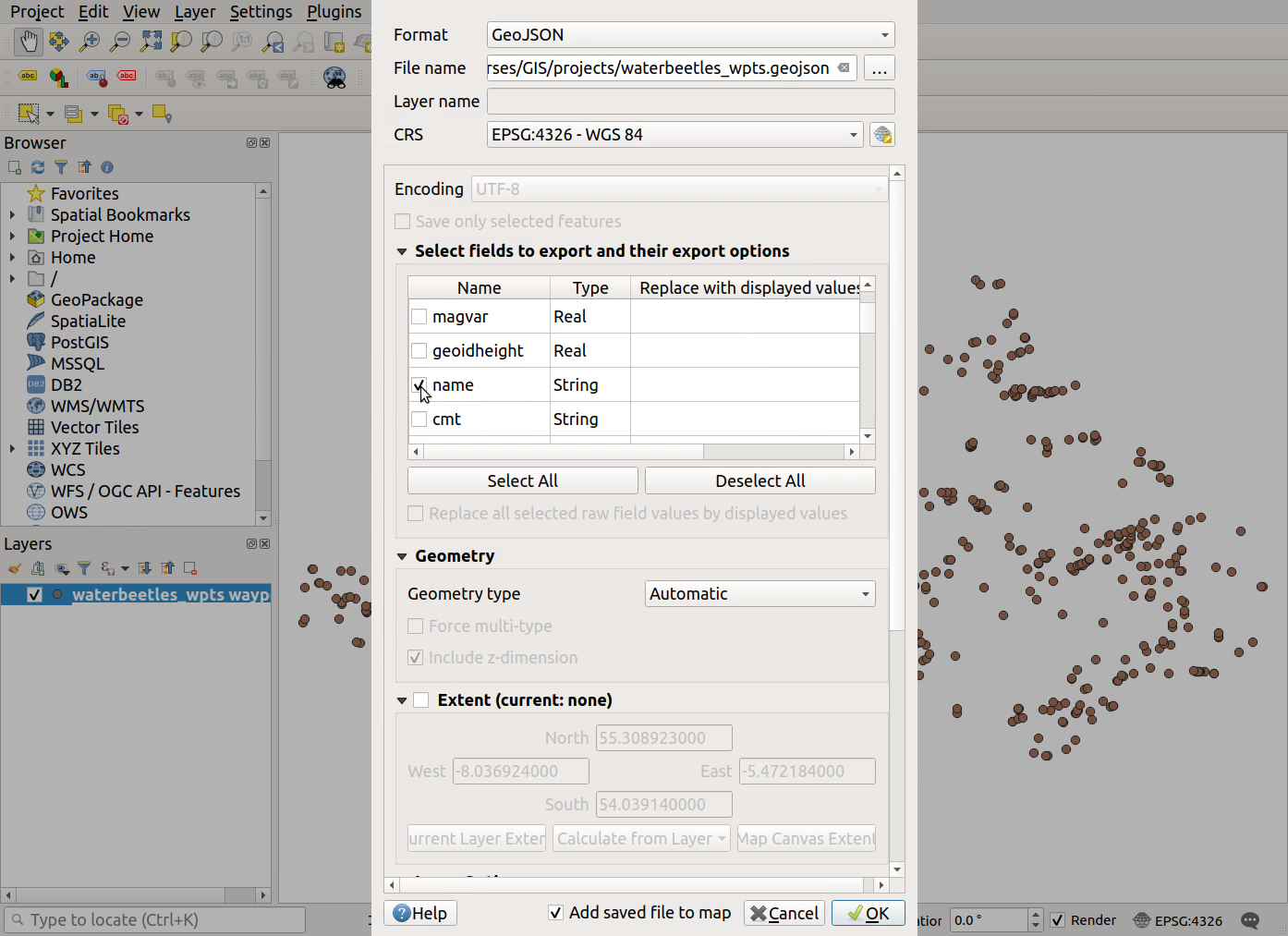
If your locations were originally imported as a .gpx file, you only need to save the ‘name’ field in your export file - this is the field that contains the WPT name
- Right-click on your locations file (.gpx, .txt or .csv) >
Export>Save Features As...- Choose the file
Format: GeoJSON or ESRI Shapefile- Click the
...button besideFile nameto specify a location and name for your new file- For .gpx files only, click on
Deselect Allthen click the checkbox beside ‘name’ to ensure we save the WPT names. Click OK to save your file- Remove the original .gpx file from your project: right-click on it >
Remove Layer...
- Right-click on your locations file (.gpx, .txt or .csv) >
Export>Save Features As...
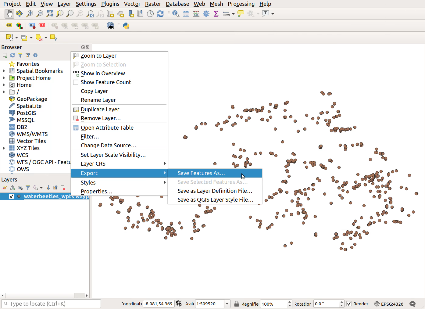
- Choose the file
Format: GeoJSON or ESRI Shapefile
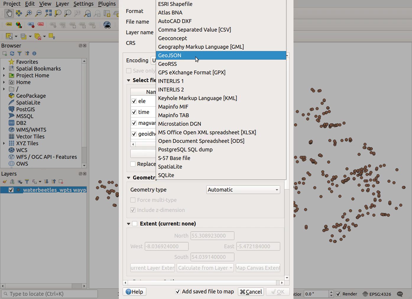
- Click the
...button besideFile nameto specify a location and name for your new file
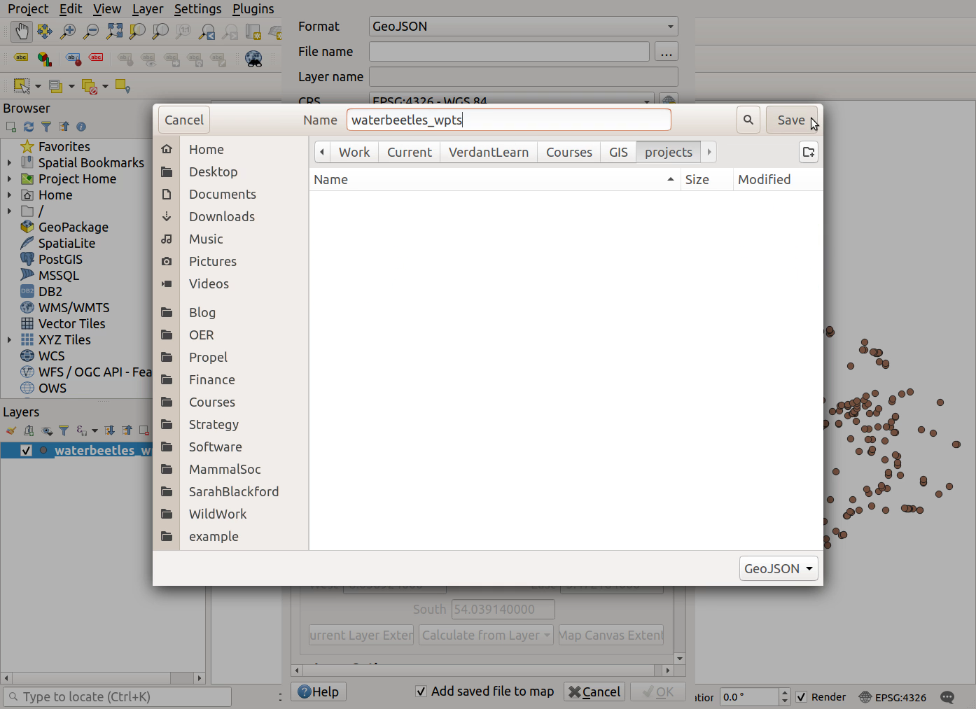
- For .gpx files only, click on
Deselect All
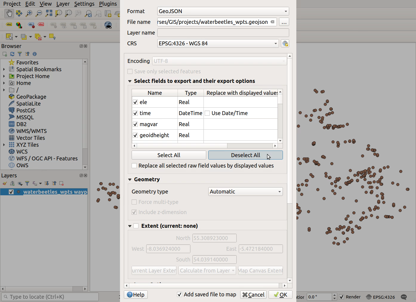
- Click the checkbox beside ‘name’ to ensure we export the WPT names
- Remove the original .gpx file from your project: right-click on it >
Remove Layer...
Previous submodule:
Import GPS locations