Add your field observations to QGIS
15 minutes
Re-open the QGIS project that contains the waypoints you imported previously, and import your field data by following the steps below
Note that nothing will be drawn on the map after this stage! Our spreadsheet lacks coordinate data, so QGIS cannot draw features on the map, but your field observations are stored and visible as a data table, ready to be joined to the waypoints in the next module
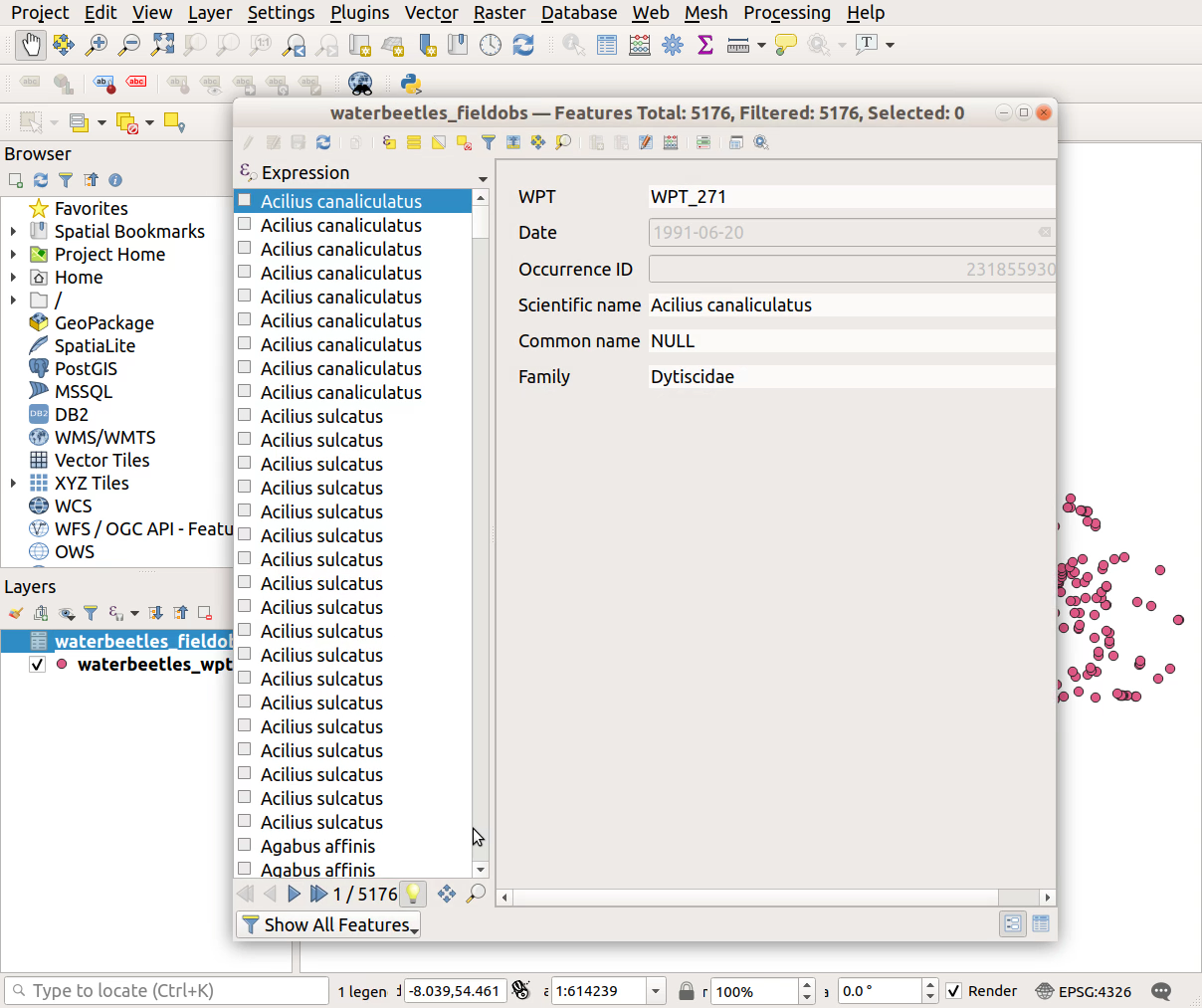
The final step below is to open the attribute table to check your data imported correctly. Do they look the same as in the original .csv file?
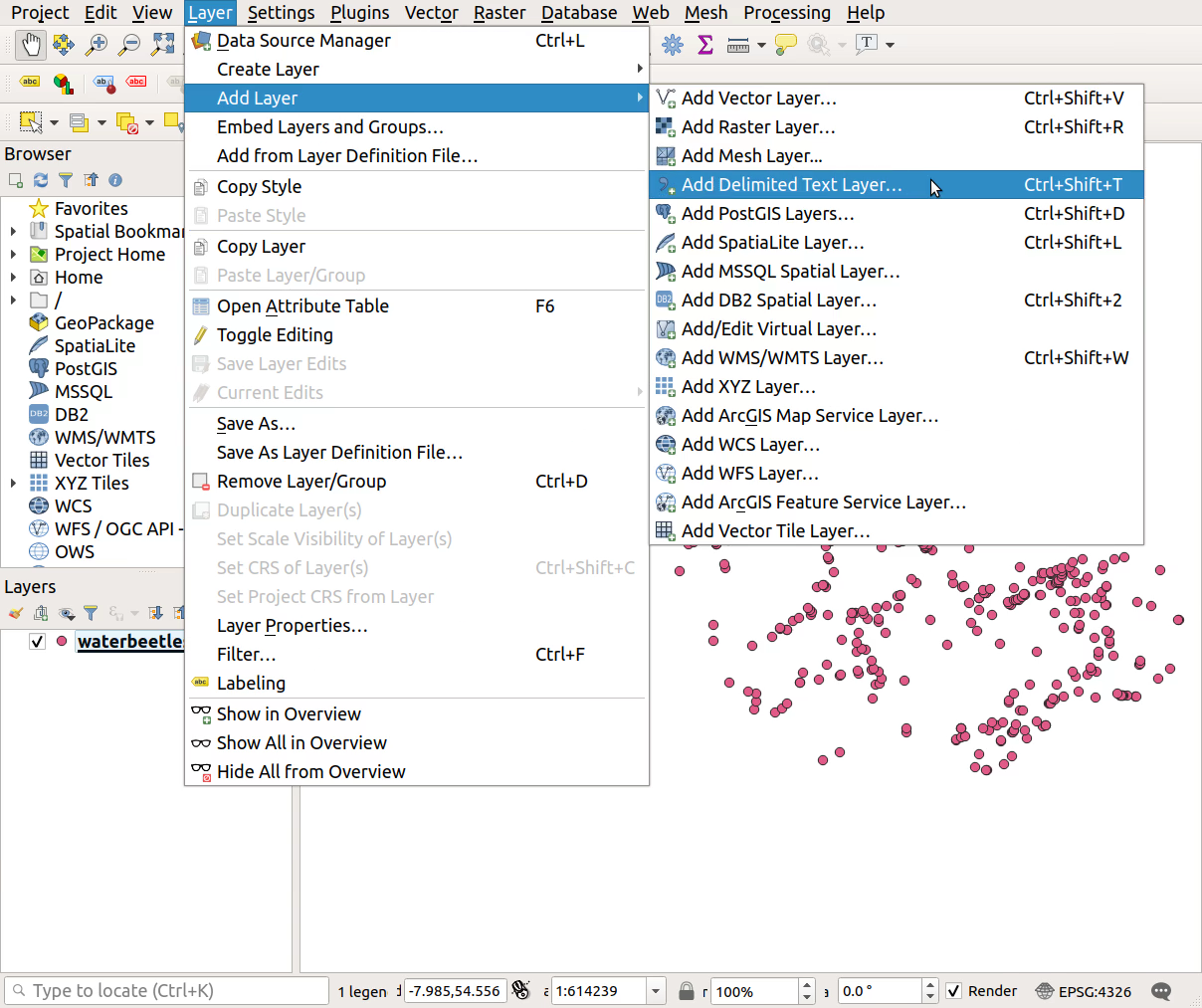
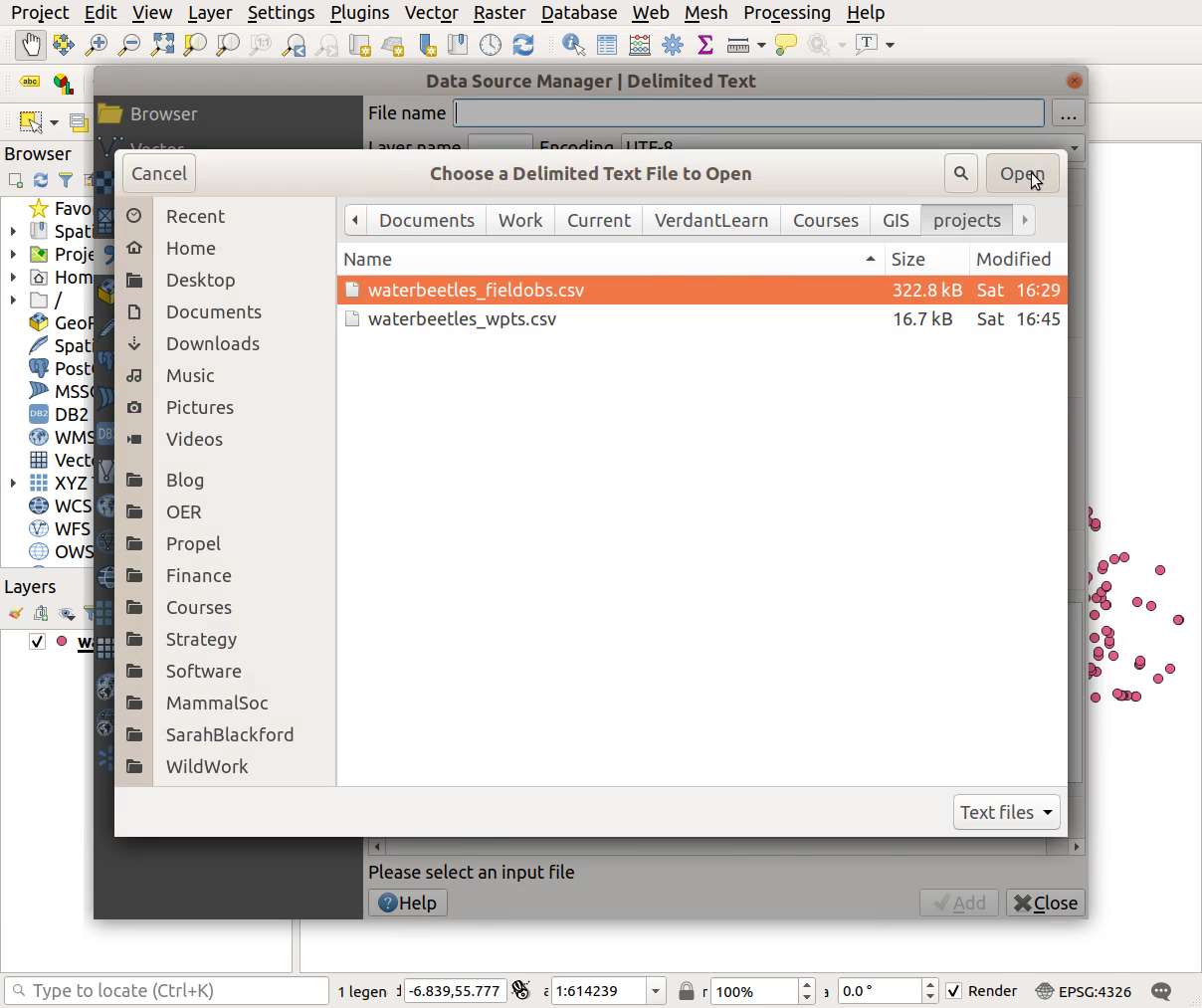
Layer > Add Layer > Add Delimited Text Layer...- Choose source file - click the
...button- Ensure
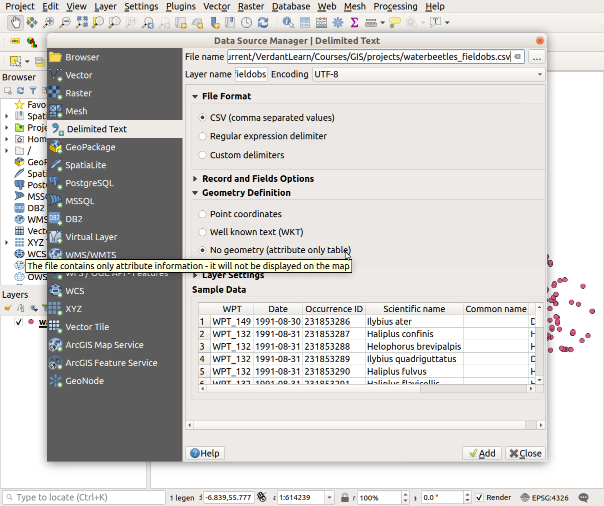
No geometry (attribute only table)is selected underGeometry Definition, then clickAddandClose- Right-click on layer in Layers tab >
Open Attribute Table- Check that your imported records look sensible
Instructions including screenshots:
Layer > Add Layer > Add Delimited Text Layer...
- Choose source file - click the
...button
- Ensure
No geometry (attribute only table)is selected underGeometry Definition, then clickAddandClose
- Right-click on layer in Layers tab >
Open Attribute Table
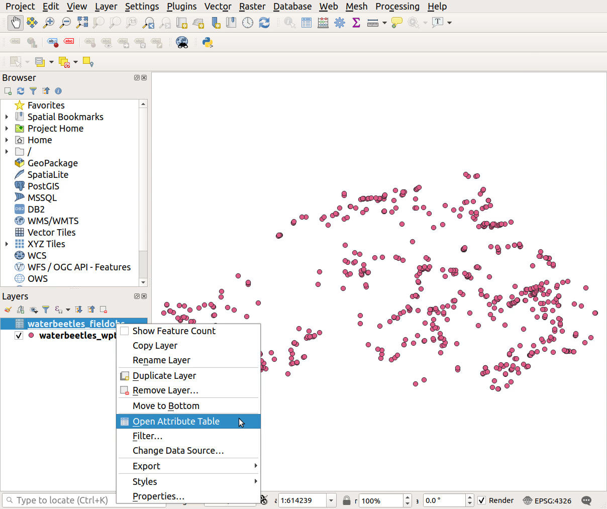
- Check that your imported records look sensible
Previous submodule:
Prepare field obs