Add metadata to your map
Maps should always indicate the source of their underlying spatial datasets, and the author and date of creation. You can also add a title to highlight your message
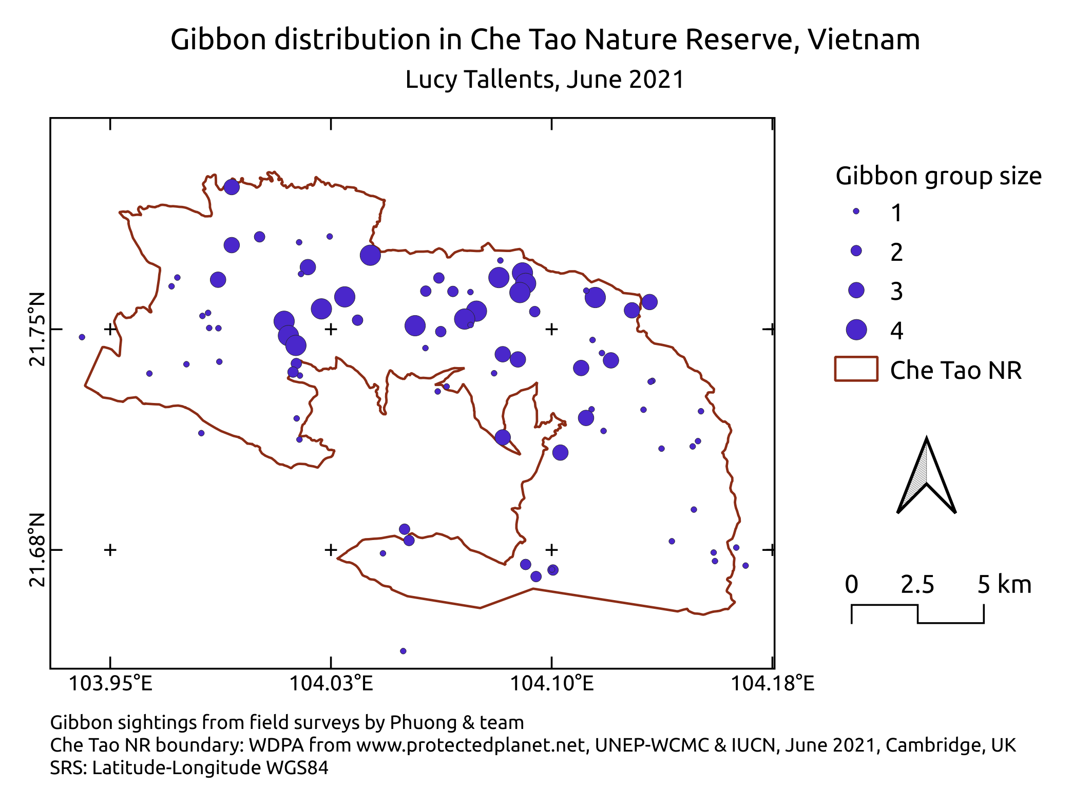
By the end of this exercise, your map will look something like this:
Title
- Select the
Add Labeltoolon the Project toolbar, and click on the map where you want your text box to be. Click
OK- In the
Item Propertiestab, type in the text of your title, where it says Lorem ipsum underMain Properties- Adjust the font size by clicking on the
Fontdropdown box- Experiment with the other settings if you wish, e.g. Horizontal and vertical alignment,
Author and date
- Use the
Add Labeltool
Data sources
By including information on your data sources, you enable your readers to assess their relevance, validity and reliability, and acquire the source data themselves if its publically available
- Add another Label with the
Add Labeltool
Export your map as an image
Now you have a completed map, you can export it from QGIS for inclusion in reports or as a stand-alone graphic
- In the QGIS
Print Layoutwindow, go to theLayout menu > Export as Image
Amazing work! ![]()
Previous submodule:
Map legend
Next submodule:
Reflection