Geodetic datums
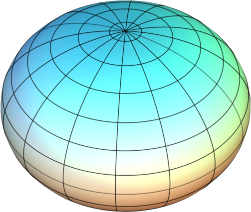
The earth is not a perfect sphere. It is slightly squashed (wider across the equator than from pole-to-pole) because of the flattening force of its rotation. It also has an irregular, bumpy surface caused by variation in the density of material below the earth’s crust, which affects local gravitational forces. These ‘imperfections’ mean that we cannot calculate locations accurately by modelling the earth as a perfect sphere
- Ellipsoid
- In GIS, a reference ellipsoid is a mathematical model which describes the shape of a flattened sphere representing the earth. Ellipsoids are defined by the length of their semi-major axis (equatorial radius), and the amount of flattening

- Geodetic datum
- Reference frame for defining horizontal or vertical coordinates on a surface
Multiple different geodetic datums exist, each designed to model the shape of the earth’s surface over a particular geographic extent; a country, continent, or as a global compromise. Old paper and digital maps are often drawn using historic global or national datums that may no longer be in use
As information from orbiting satellites has improved our knowledge of the earth’s shape and gravitational fields, more accurate datums have been developed. The most commonly used ellipsoid and datum are WGS84, a model developed in 1984 from newly-available satellite information. It is designed to be suitable for global datasets, and has risen to prominence because of its use in GPS systems